What's actually being built, and when
Official plans first: the real architectural drawings, the government's own scale diagram, the published construction schedule, and the first physical work already on the ground — followed by clearly marked artist impressions showing what the disclosed scale could mean at eye level.
This is a living page. It will grow as more plans, drawings and dated evidence become available — each addition sourced and dated like everything else on this site. Last built: 14 September 2026.
Sources: EOI, Oct 2025 (Stage 1 scope and 2028 date); Infrastructure WA, Mar 2023 (full 176-bed vision and $698.3M).
What's being built, and where
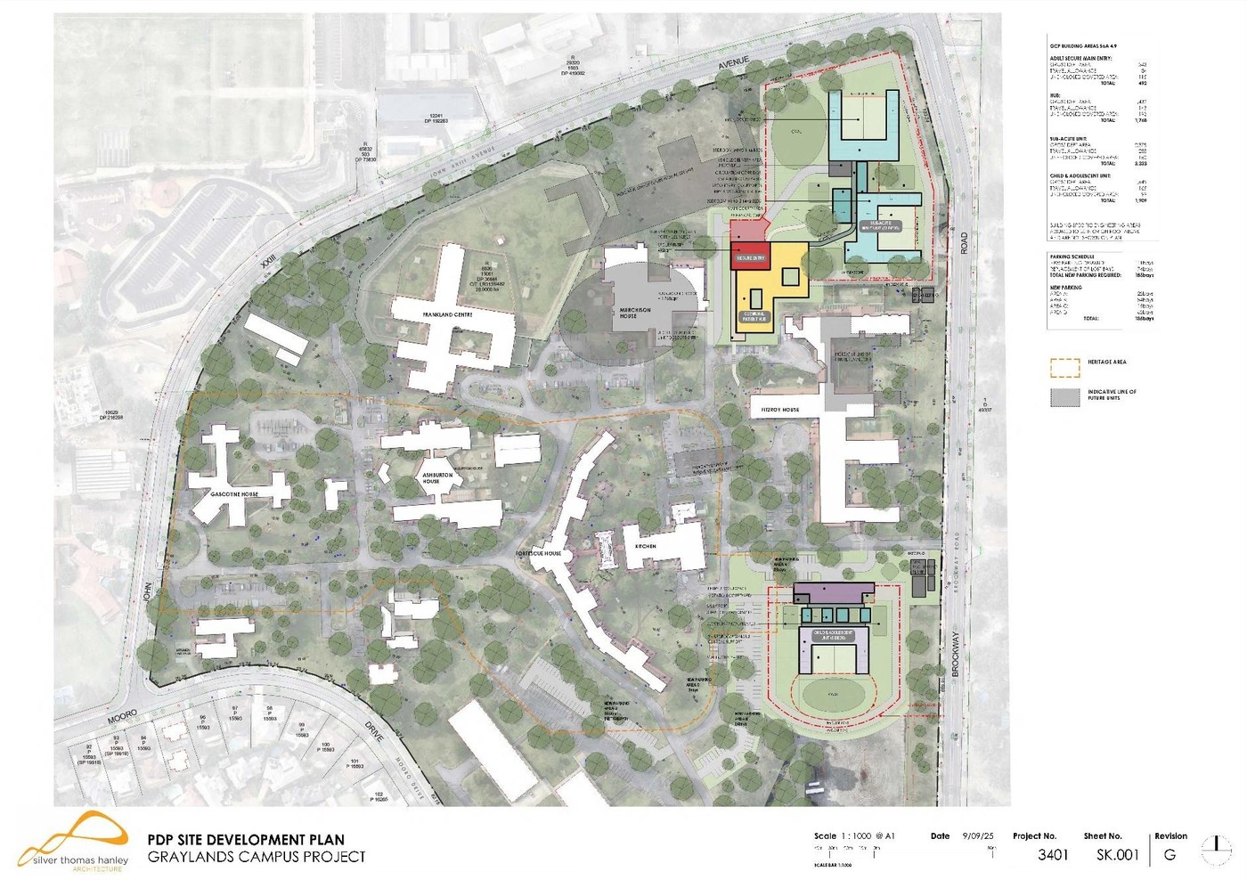
The plan at the top of this page is the site development plan the State issued to construction companies bidding to build Stage 1 — the first time the actual building footprints, not just bed numbers, have been made public. Set against what's there today, two things stand out.
What's there now
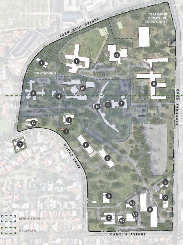
The current hospital layout — the Frankland Centre, heritage-listed houses, and, marked in green, an odour line running through the site. More on that below.
A named, mapped Child and Adolescent Unit
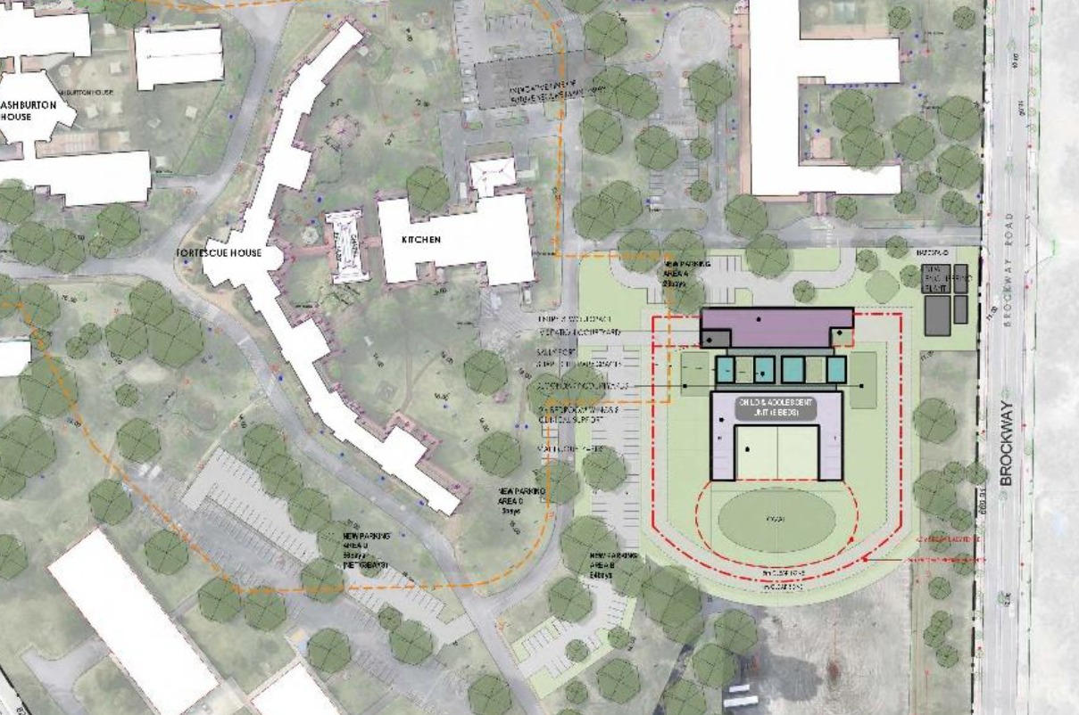
The building schedule lists the Child and Adolescent Unit as its own line item, with its own footprint alongside existing buildings in Graylands. The red dashed line is a secure perimeter separating the facility into secure and unsecure zones, 400m away from Quintilian School.
This image is reproduced at the resolution available in the published tender document — the official record, not a rendering issue on our end. Some labels are legible only in parts.
Source: EOI Schedule 2, Parts A & B. Some smaller area figures on the original building schedule are too small to read reliably even at full resolution; we haven't guessed at them.
One secure compound today, growing to three
Frankland Centre operates today as a single secure, fenced facility — WA's only current forensic mental health unit. Nothing in the tender drawings shows it being decommissioned or its perimeter changed; it keeps operating throughout construction. Stage 1 adds two more secure compounds beside it, each with its own perimeter and its own set of security buffer zones: the Adult Secure Main Entry, Hub and Sub-Acute Unit cluster, and — separately — the Child and Adolescent Unit. One secure compound growing to three, on the same campus, before the long-term plan's further expansion is even considered.
Both of the new compounds front directly onto a public road. The Adult Secure Main Entry cluster sits against John XXIII Avenue. The Child and Adolescent Unit sits against Brockway Road — the same road Quintilian School fronts, about 400 metres further south. Anyone driving or walking that stretch of Brockway Road will have a secure forensic compound on one side of the road and a primary school on the other, within a few hundred metres of each other.
Government has already told us how much land this disturbs — no estimate required for the headline number. The same RPS environmental report defines an "indicative disturbance area" of 3.54 hectares for the two new compounds, and says exactly what that figure covers: "the building/infrastructure footprints, inclusive of patient courtyards and secure perimeter, and perimeter management zones" — meaning the buildings, the yards inside the fence, the fence line itself, and all three buffer zones around it, combined RPS, Environmental Impact Summary, 1 Sep 2025, p.2. A regulation football pitch is 0.714 hectares. 3.54 hectares is close to five of them — disturbed, cleared, and brought inside a security-managed boundary, for two compounds that don't exist today.
That figure describes the two new compounds together; it isn't broken down per compound, and it isn't the same thing as "fenced compound" in the narrower sense — it also includes buffer strips that may sit outside the actual fence line, so treat it as the full managed footprint, not a literal fence measurement. For a sense of what's there today by that narrower measure: Frankland Centre's own compound, estimated from the scaled site plans and aerial imagery, covers approximately 1.4–1.6 hectares — around two football pitches on its own.
Put plainly: a compound covering around two football pitches today is being joined by two more compounds whose combined managed footprint — on the government's own figure — runs to nearly five football pitches more. Together, that's upward of five hectares of fenced, cleared, security-managed ground where there's just under two today — over three times the current footprint. There is no reading of those numbers where this is a modest addition. It's a step change in how much of this site is fenced, cleared and security-managed, right along two of Mount Claremont's busier roads.
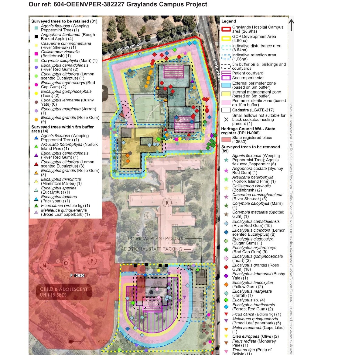
Government's own environmental consultant had to map the security architecture layer by layer to work out which trees could stay. Around each of the two new compounds, outside the secure perimeter itself, the design places three concentric zones: an external perimeter zone of 6 metres, an internal management zone of a further 6 metres, and — the consultant's own term — a perimeter sterile zone of 10 metres. Every tree standing inside any of those zones is marked for removal RPS, Environmental Impact Summary, 1 Sep 2025, pp.2, 18.
These three coloured zones must not be read as three fence lines. The RPS figure is a vegetation and disturbance assessment. Its coloured bands identify security-related planning and buffer areas around a separately marked "secure perimeter"; they are not a fencing schedule and do not establish how many physical barriers will be built.
The later tender site-development plan is the better available guide to alignment. Its linework appears to show a principal secure boundary around each new precinct, together with local courtyard and recreation-yard enclosures. But the published material still does not provide a complete fence legend, elevation or specification. Fence height, mesh, anti-climb treatment, lighting, surveillance and the final number and position of barriers therefore remain unconfirmed.
A dedicated secure perimeter is used because these facilities hold patients under detention or custody orders — not the informal, unlocked model of a general psychiatric ward. Absconding is already frequent at WA's existing facility, and failures cluster specifically at the transitions between security levels see Concern 1, the full documented record →. Going from one secure facility to three is not a cosmetic change in how the site looks. It creates two additional secure precincts and many more controlled transitions on one campus — and those transitions are exactly where the documented failures matter.
Coming: two more compounds, 3.54ha disturbed between them
Top right, against John XXIII Avenue: the Adult Secure Main Entry, Hub and Sub-Acute Unit. Bottom left, against Brockway Road, ringed by the identical blue/yellow/pink zone pattern at a smaller scale: the Child and Adolescent Unit — the compound on the same road as Quintilian School. The shaded area is the State heritage place; the development clips its boundary, and up to four trees inside it are marked for removal.
Figure 2, RPS Environmental Impact Summary, prepared for the Office of Major Infrastructure Delivery, 1 September 2025.
This is a construction and vegetation document, not a security plan. It shows the managed footprint and the consultant's zone terminology, but it does not establish three fence lines or disclose fence heights, detailed security treatments, lighting or surveillance.
What this scale could look like
The tender drawings show where the buildings and secure boundaries are proposed, but they do not show what the development may look or feel like from ground level. These impressions translate the publicly disclosed footprint into possible views so readers can understand the potential building mass, perimeter length, clearance areas and night-time presence.
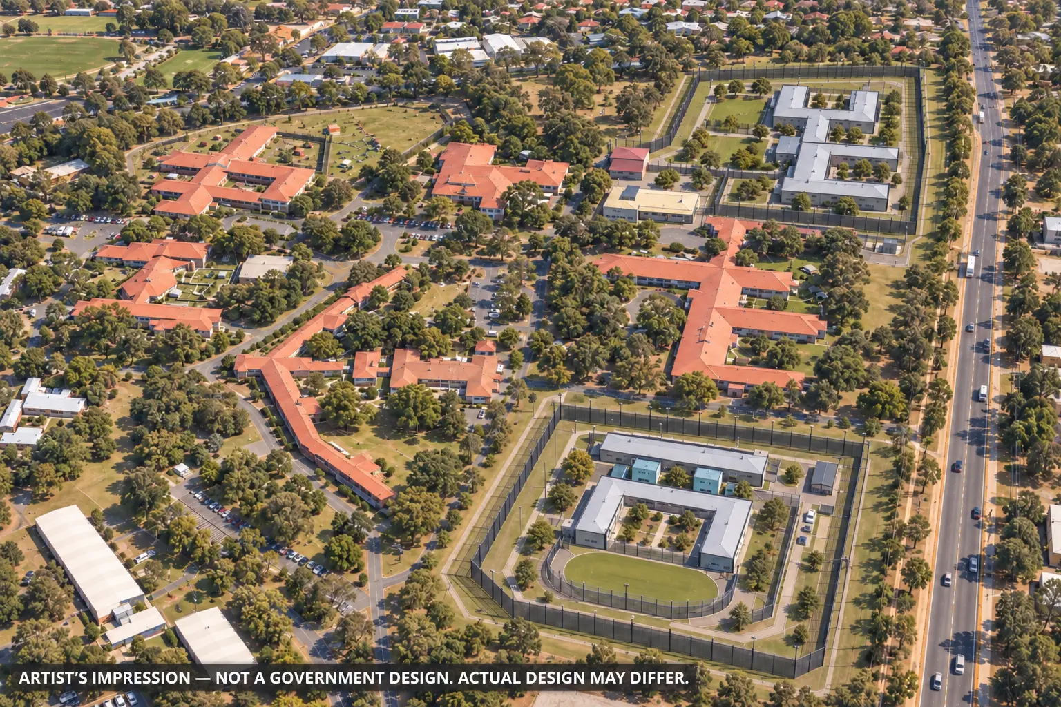
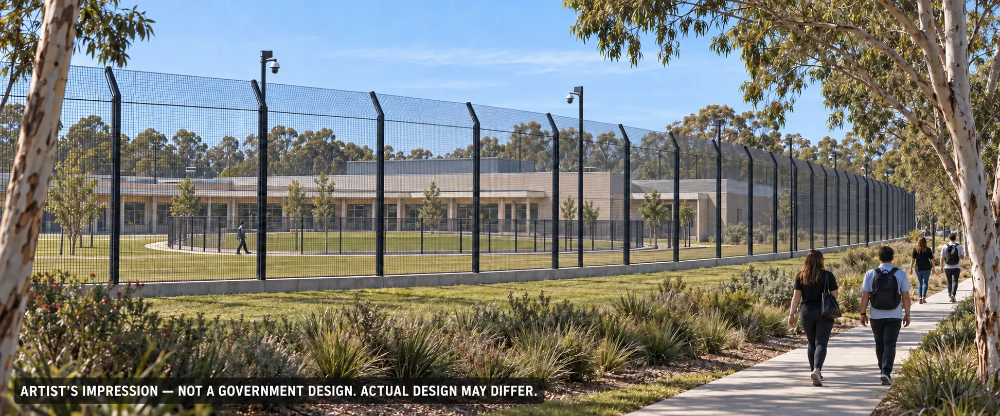
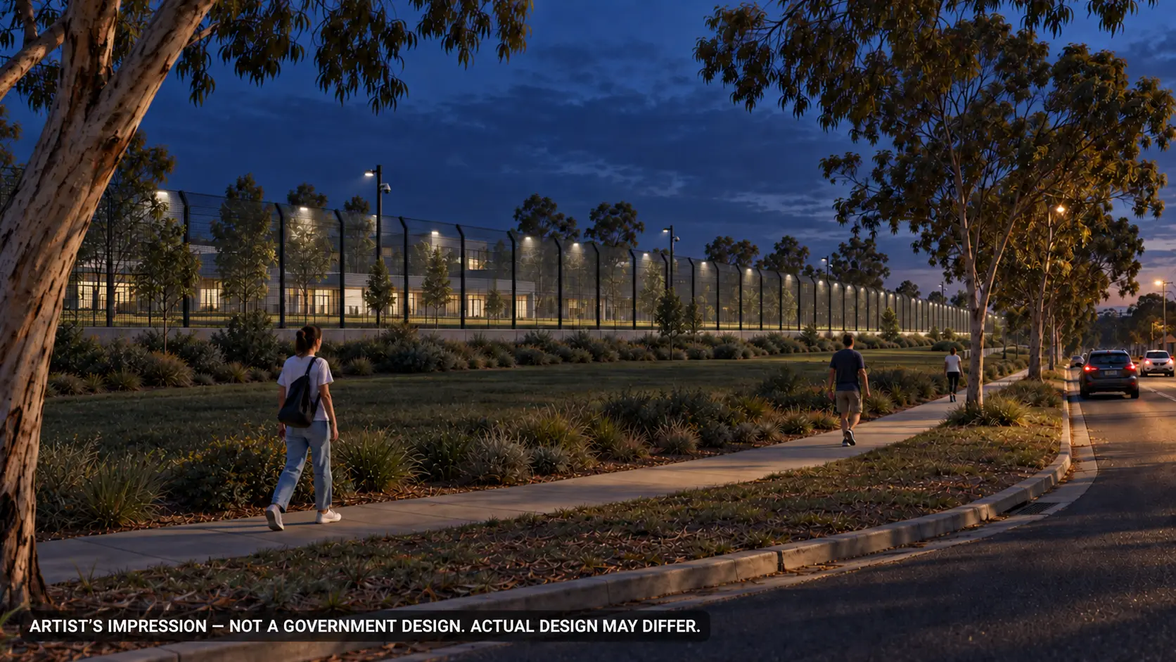
Why publish impressions at all? Because plans read from above do not readily convey eye-level scale. These images do not fill the government's information gap with claimed facts; they make the gap visible while showing one plausible scenario based on the limited information available.
How close is close: the Child and Adolescent Unit
The school-boundary page above talks about the campus in general. This is about one specific, secure, fenced unit — and how close it sits to a school with around 160 young children.
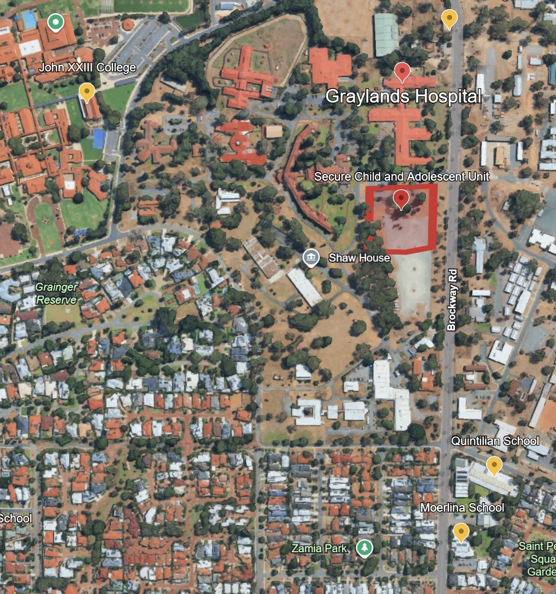
That's a fenced, secure unit for children and adolescents under a custody order, roughly 400 metres from a school gate. The perimeter shown isn't incidental — it's there because of who the unit is designed to hold, at a security level the government itself has classified as requiring a dedicated fenced boundary within the wider site.
The rest of the Stage 1 works
The tender also covers relocating the Claremont Therapeutic Riding Centre — which currently sits inside the footprint of the new build — to a new site across John XXIII Avenue. Government has allocated $10.6 million to the relocation WA Government media statement, 9 Apr 2026.
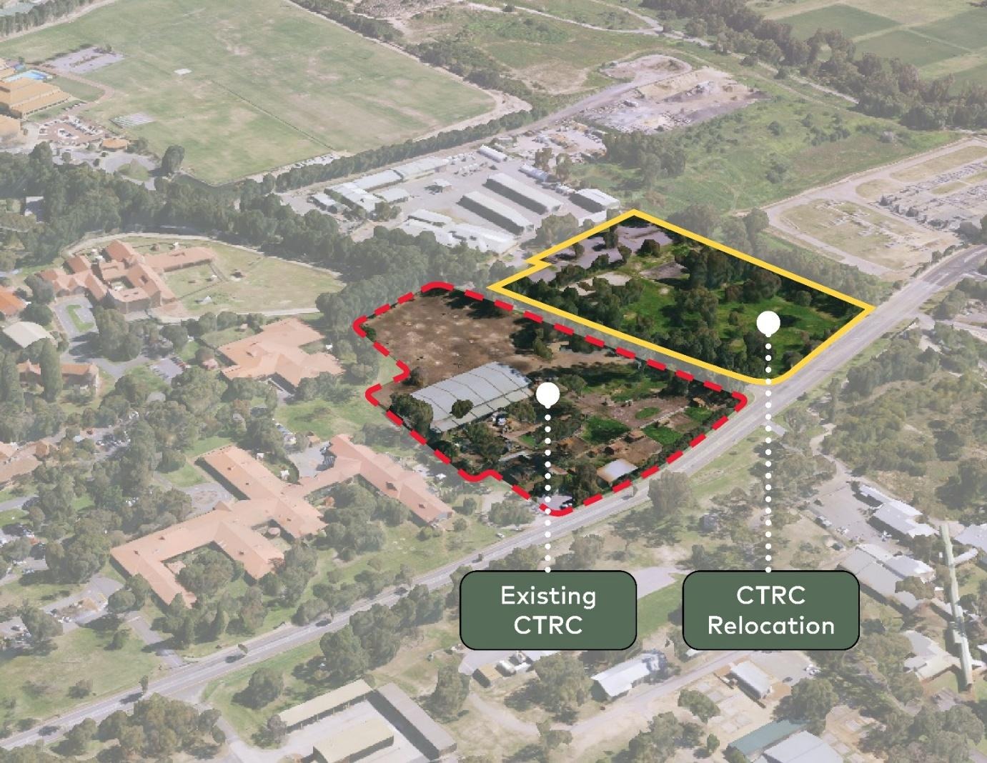
Existing CTRC → relocation site
The riding centre — which provides therapy for people with disability — has to move to make room for the new build. Its replacement site sits across John XXIII Avenue, on what is currently open land.
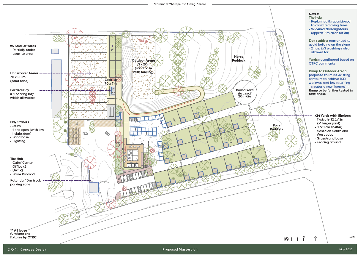
The relocation concept design
Stables, an undercover arena, an outdoor arena and paddocks — a full replacement facility, concept-designed in May 2025. Relocation works began in the field in September/October 2026. Asked directly in Parliament, the government confirmed the relocation is expected complete by mid-2027, with the Graylands Campus Project's main works expected to follow it WA Parliament, QoN 3186, 15 Sep 2026.
How big the full vision is
The tender above covers Stage 1 only — the 40-bed slice that's actually funded. The diagram below is different: it's the State's own original masterplan option for the entire northern campus, submitted to Infrastructure WA in December 2022 as part of the business case IWA reviewed in March 2023. It's the clearest single image of what "176 beds" actually looks like on the ground.
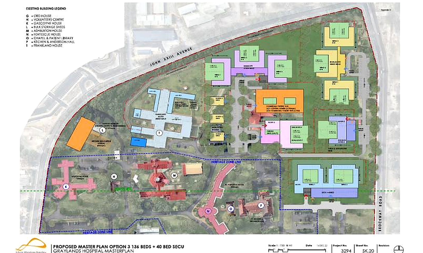
Proposed Master Plan Option 3 — 136 + 40 beds
Silver Thomas Hanley Architecture, drawing SK.20, 14 December 2022 — the option Infrastructure WA assessed and recommended proceed to a funding decision, in stages, the following March. Only the smaller Stage 1 slice shown above has actually been funded so far.
Reproduced at the resolution available in Infrastructure WA's published assessment report — the best publicly available copy, not a rendering issue on our end. The overall layout and zones are clear; some small in-block labels are not.
A risk flagged in 2022, before construction was even funded: Infrastructure WA's own assessment noted that "substantial redevelopment" on this site falls within the Subiaco wastewater treatment plant odour buffer, and recommended the impacts and mitigations be clearly set out before a funding decision. The same odour line is marked on both this 2022 masterplan and the existing site plan further up this page — we haven't been able to confirm whether the recommended assessment was ever published.
Source: Infrastructure WA, Major Infrastructure Proposal Assessment, March 2023
What's already there
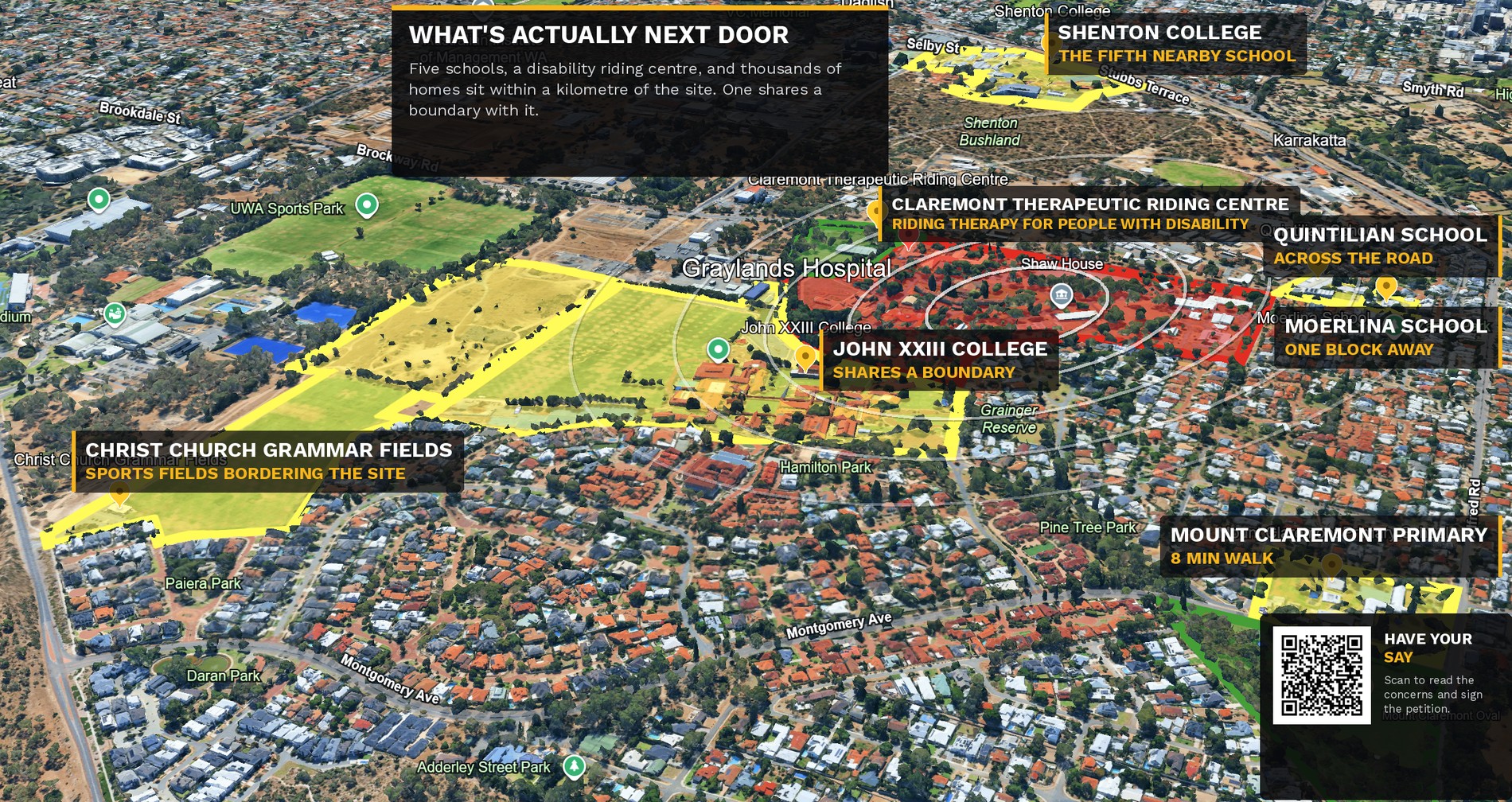
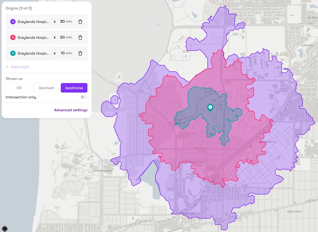
The plans above sit inside an established, densely used neighbourhood — not a buffer zone. This is the same annotated aerial from the homepage, for reference alongside the plans on this page. How it came to look like this →
The published timeline
Two different processes, on two different clocks: the political/funding timeline already covered on the issue page, and the construction procurement timeline below, drawn from the tender documents themselves.
Sources: EOI, Oct 2025; Infrastructure WA, Mar 2023. The EOI can't name the winning contractor since it predates selection, but the scope and dates line up closely with the ADCO engagement above.
Every contract behind that timeline
The dates above are the headline moments. The government's own contract-disclosure register has the full paper trail behind them: 28 contracts for planning, design and early works, awarded between October 2022 and August 2026, totalling $8,958,992 — none of it for construction itself. Twenty firms have been paid so far, from the architects who scoped the earliest options through to ADCO Constructions and Turner & Townsend above.
This isn't the project's cost. $8,958,992 is what's been paid for planning, advice and early contractor involvement — the announced $698.3 million capital figure at the top of this page is separate, and covers something much larger. What this register shows is sequence: who was contracted, when, for what, and how it built up to where things stand now.
On the ground now
3 September 2026 — a resident stopped to speak with a work crew carrying out electrical infrastructure work at the John XXIII Avenue boundary of the site. Asked what it was for, the crew confirmed it was for the proposed development.
It's the first physical sign most residents have seen with their own eyes — and it lines up with the EOI's own Q2 2026 target for site works to begin. OMID's own project fact sheet, reissued in September 2026, lists "October 2026" against "works to relocate the CTRC commenced" — a month later than the same claim in the August 2026 edition OMID, Graylands Campus Project Fact Sheet, Sep 2026. The same document still lists "construction commences" against "to be determined." Parliament has since put a shape on what follows: the government told the Legislative Assembly the CTRC relocation is targeted for mid-2027, with the campus's main works expected to follow it WA Parliament, QoN 3186, 15 Sep 2026 — the clearest sequencing confirmed so far, even though "construction commences" itself remains undated.
What the government's own tender says about community reaction
"Stakeholders – deliver the Project engaging proactively and positively with the community without causing any adverse stakeholder reaction."
One of seven listed project objectives, alongside quality, schedule, cost and safety. Source: EOI, Section 2.3
Read plainly, the objective isn't to seek community agreement — it's to avoid a negative reaction becoming a delivery risk. That's a reasonable thing for a construction schedule to worry about. It's a different thing from genuine consultation, which is the entire basis of this campaign's ask.
If seeing the actual plans changes how "176 beds" or "$698 million" lands for you, the petition is the fastest way to register that.
Sign the petition